In modern mining, the integration of photogrammetry and LIDAR provides a comprehensive solution for precise data capture and detailed terrain modeling.
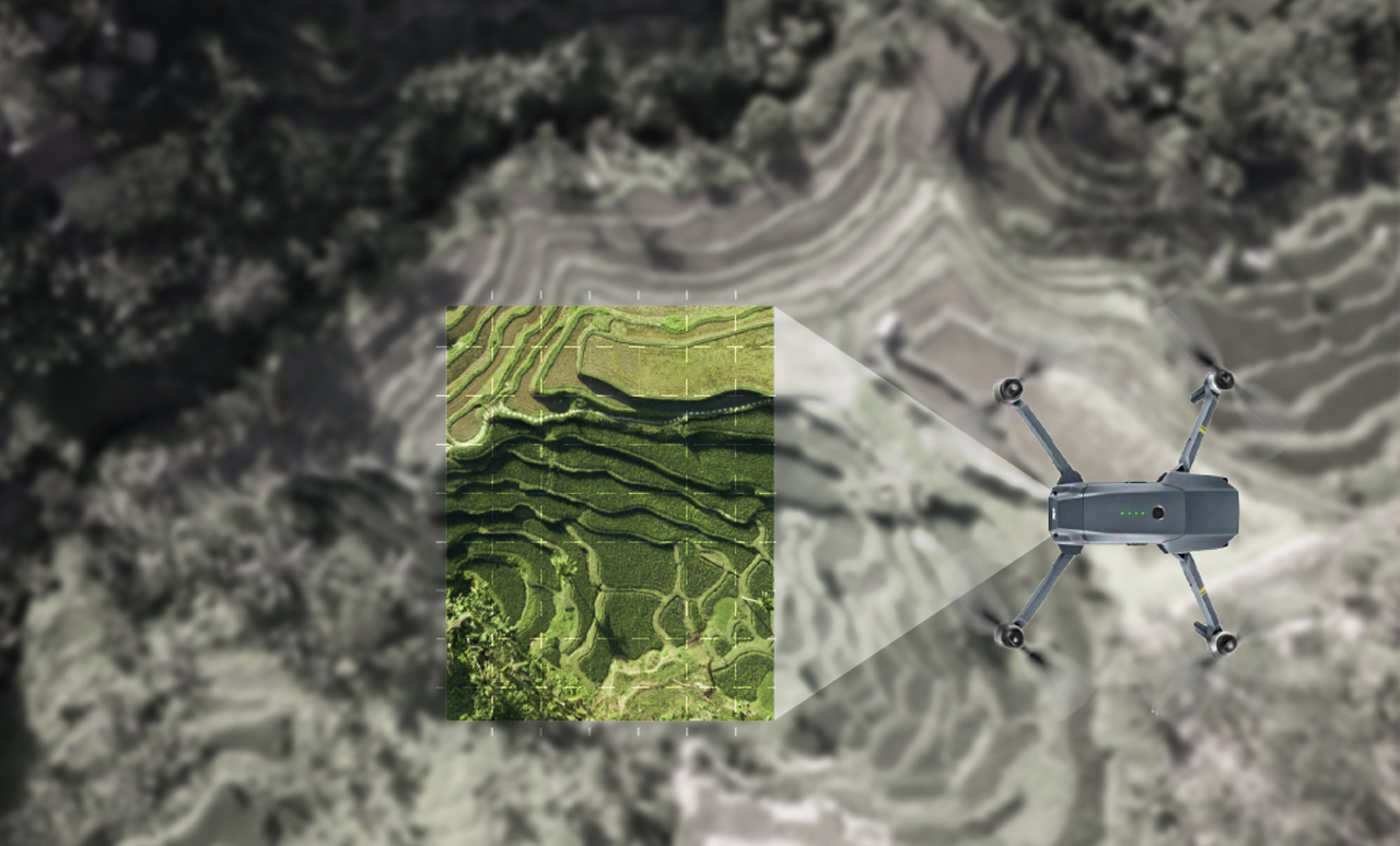
Photogrammetry: This technique uses aerial imagery captured by drones or aircraft to create detailed 3D models and accurate terrain maps. It is ideal for mining exploration and monitoring, offering a clear and comprehensive view of the area under study.
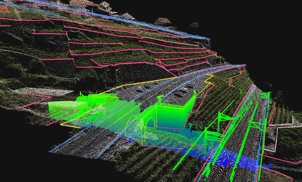
LIDAR: Using laser pulses to measure distances with high precision, LIDAR generates 3D models of the terrain and structures. This method is especially valuable for acquiring detailed topographic data and analyzing geological features in hard-to-reach areas.
APEX integrates photogrammetry and LIDAR to provide an advanced solution for modeling and analysis. By combining data from both technologies, APEX optimizes data processing and visualization, improving the planning and management of mining operations. The ability to merge data and generate accurate models makes it an invaluable tool in the mining industry.